Drones have revolutionised stockpile measurement in the last few years. Gone are the days of trudging up and down piles of aggregate with a GPS rover, and gone too are many of the accidents which used to ensue from losing footing on a precipitous pile of pumice. Not that we don’t need to get our boots dirty from time to time, but it’s quicker and easier than it was.
The trouble is, no two stockpiles are alike. So I thought I’d share some of the tricks we use to measure stocks for our aggregates clients as accurately as possible.
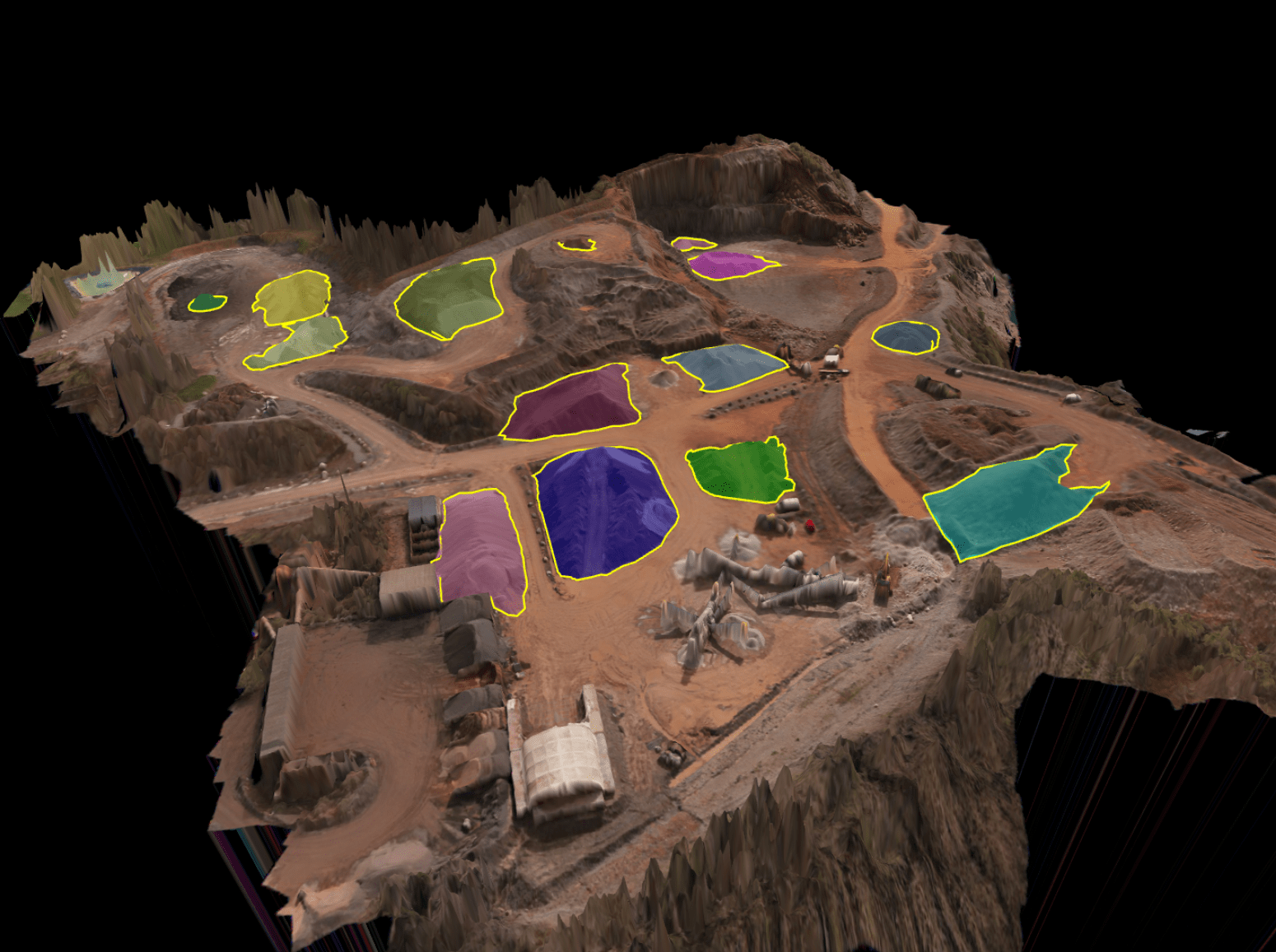
Creating the Baseline
The key to a stock measurement is creating a reference surface, or baseline. In other words, what is the underlying terrain against which we are trying to measure? This is the ultimate starting point, and for a regular site it’s well worth the time to create a model of the entire location. But it’s a time-consuming task, so often we’d focus only on the areas where we’ll be measuring stocks. In this example, we’ve created a surface just where the stock is sitting, allowing us to get results quickly.
In the absence of a site-wide baseline, the art is all about determining the particular stock situation we’re dealing with. For example,
- Is it on flat or sloping terrain?
- Is it backed up onto something else, for example another stock or a storage bay?
- Is there anything within the stock area which we should not be measuring? e.g. plant or boulders
Each of these needs its own approach. Read on to find out how we tackle them.
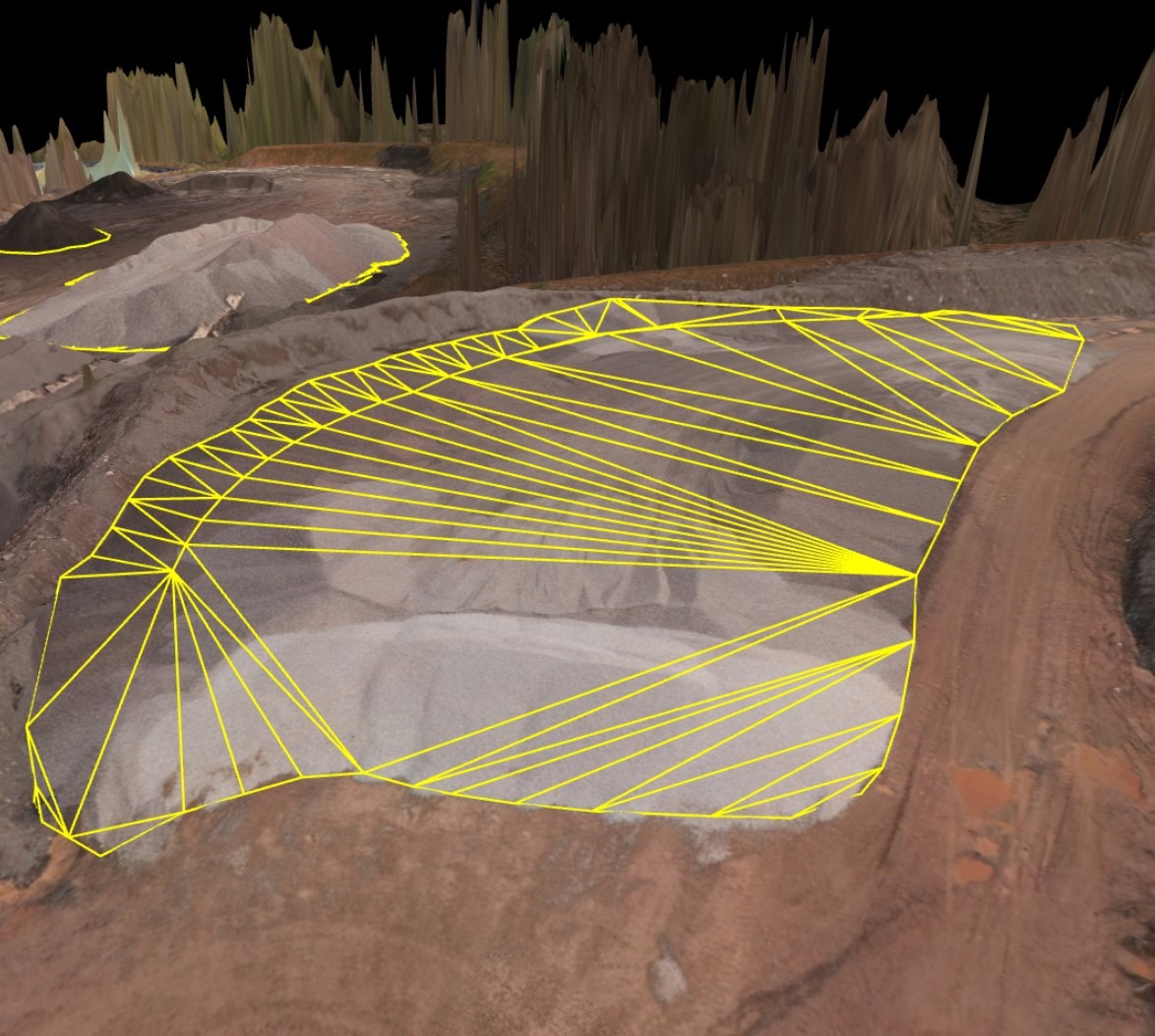
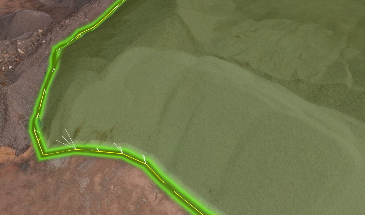
Dealing with Sloping Terrain
The great thing about the analysis software we use is that we can quickly create a reference surface derived from the boundary of the stock itself. In essence, we trace a line around the terrain at the base of the stock and then interpolate a base using the resulting vertices. A lot of the time this works really well.
BUT there is a pitfall. What if the terrain underneath is undulating? The stock below is a great example. The white lines show the interpolated reference surface and it is clearly not capturing all of the material. In this case, the only option is to build a more complex representation of the underlying surface and then reference that. This is where some of the skills and attention to detail come into play.
The Curse of the Storage Bay
Storage bins/bays also need some special care. The problem here is that much of the perimeter of the stock can be impossible to see. Plus, we don’t want to measure the fabric of the bin itself.
We find that the best approach is to define the area of the stockpile from a nadir position (top-down) as accurately as possible. We can then take the elevation at the front of the stock (where we can see the ground) and then, if the bay is sitting on flat ground, apply that elevation right around the stock perimeter. Where the bay is on sloping ground, we can interpolate the reference elevation from front to back of the bin. It’s fiddly, but very effective!
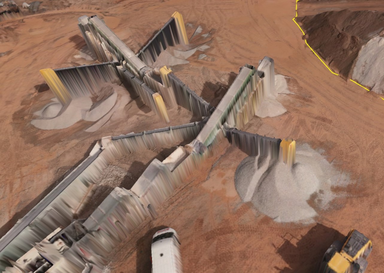
The Clean-up
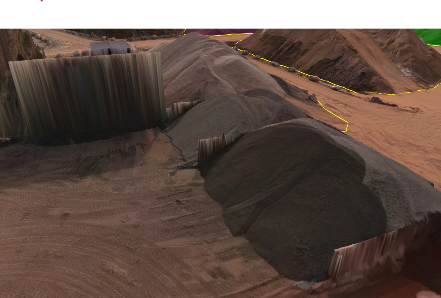
Finally (at least in this short tour), what do do when there is something sitting on your stockpile which you don’t want to be measured? For example, boulders, vehicles or, in the case below, conveyors and screening equipment.
The answer here is clean-up. Thankfully, machine learning and some neat coding have made this process incredibly quick. We use a ‘remove object’ tool which, in essence, lets us point-to-zap the unwanted objects. It’s a curiously satisfying process which works at least 90% of the time. Even when there is some manual intervention to do in the remaining cases, most site clean-ups can be done within 20-30 minutes.
Getting in Touch
We regularly provide aerial stockpile surveys for quarries and other aggregates sites in Wales and the West of England. We are very happy to arrange a preliminary call and site visit to discuss your requirements.