(and why the second one is much better than the first)
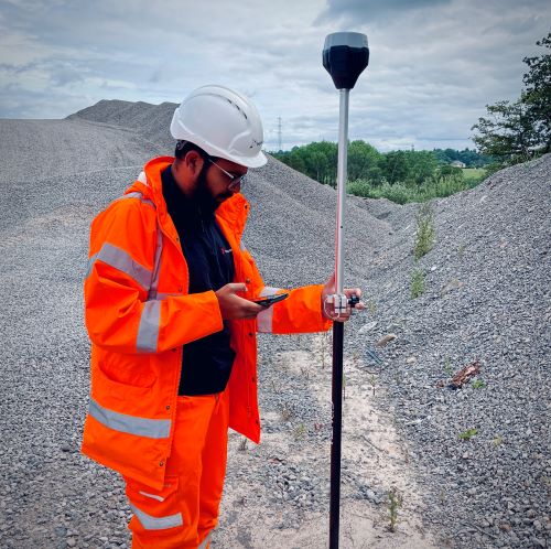
Hi, I’m Michael, Managing Surveyor at Leaping Wing. We specialise in drone data of all kinds, including large-scale topographic surveys and, increasingly, stockpile inventories.
For anyone managing an aggregates site, the speed of a drone-derived inventory is appealing, not least because the stock report is already old news the moment another lorry picks up a load and exits the quarry gate. Plus, with so much heavy plant and dust, there’s a lot to be said for avoiding the prospect of hapless surveyors scrambling over heaps of materials and playing dodge-the-dumper.
But, just how accurate are these surveys? And why is the second survey typically better than the first?
Accurate or Precise?
If the name of the game is ‘how big is my pile’, then the key consideration is not accuracy (i.e. real-world positioning) but precision. In other words, we want to be able to determine the dimensions of a pile to within, say, a centimetre or two. If the whole pile is misplaced by half a metre, that’s not going to affect our tonnage figures so, in that sense, it doesn’t really matter. Except on the return visit, but we’ll come to that at the end.
The trouble is, as with all surveying, there are errors along the way to that goal of ultimate precision. So how big might they be? Well, let’s run through them.
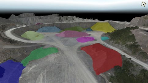
And, along the way, let’s assume we’re measuring a pile of limestone in a flattened conical pile with a diameter of 25m. We’ll call our pile ‘Bill’. His actual tonnage is 6000t..
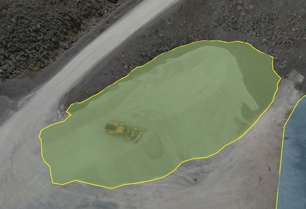
Our stockpile, Bill.
RTK
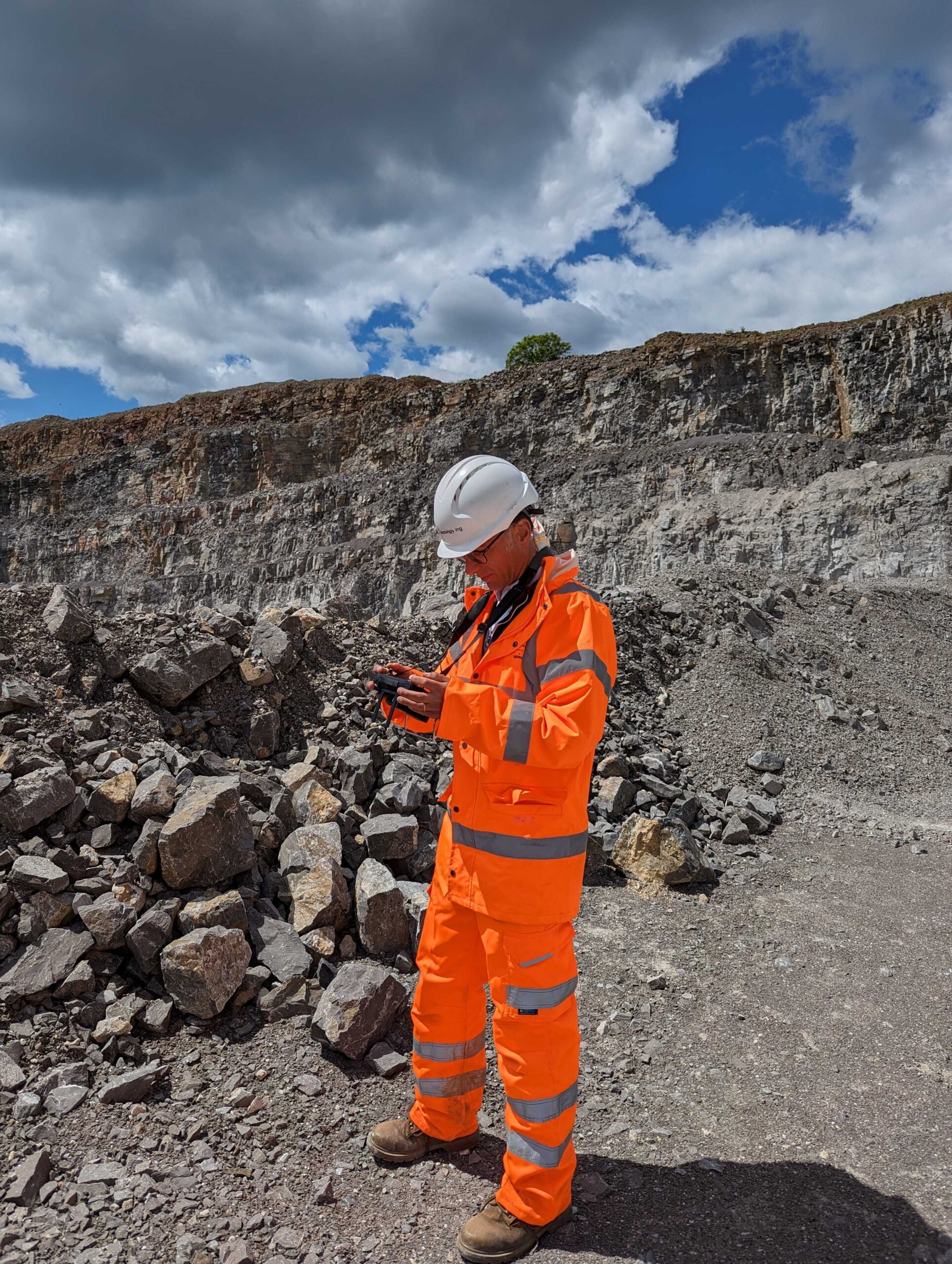
I’m going to assume that we are using Real-Time-Kinematic positioning, RTK for short. RTK massively increases the GPS positioning on which drones are reliant. It’s a company requirement to use RTK for all our stockpile surveys.
The precision of our RTK system is in the realms of 1cm + 1mm for every km away from our base station. Given that we never fly more than 1km from our base, let’s call it 11mm. In other words, images on either side of our stockpile could both be 11mm out in all (xyz) dimensions. Even with ground control we are not going to get rid of this error, so we’ll live with it.
Density Assumptions for the Materials
Stockpile volume is one thing; tonnage is another. To convert our volume to weight, assumptions about the material’s density are required. If these assumptions are off, the tonnage calculations will be too. Density ranges can be as much as 20% of the assumed figure, going between the two extremes of compaction (i.e. 10% either side of the mean). Now, we shouldn’t be estimating one extreme when the reality is the other extreme, but a 5% error on density estimate is not unreasonable.
Obstructions and Objects on the Materials
Debris, machinery, trees and other objects can obscure the stockpile, leading to errors in the survey data. We spend a lot of time removing these with some pretty intelligent tools and, for the most part, the resulting errors are pretty small. In the worst case, we might inadvertently leave this cinder block in a calculation (indeed, it might be buried under the stock). But even then, the error here is only.
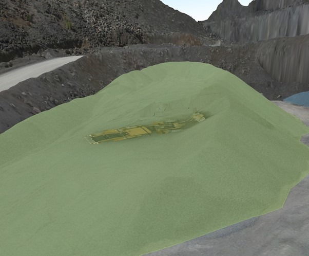
Plant removed from Bill’s volume calculation.
Assumptions About the Underlying Terrain
Here’s the big one. Almost always, our first survey is on a site which has already been stockpiled. That means we can’t be sure of the terrain beneath each stock. Is it flat or sloping? Is there a smaller mound of harcore sitting underneath as a base? Is the rockface behind it inclined or sloping. To minimise possible errors, we always get as much information as we can from the quarry site manager, but even their memories can be fallible.
Let’s see how this plays out with our old friend Bill. Here we’ve calculated the volume twice, once referencing a flat underlying surface extruded from the lowest reported point on the boundary, and once with an interpolated sloping surface guessed as best we can. The reported volumes are:
Flat base – 4626m3
Sloping base – 3417m3
This is a big difference!
Summarising Those Errors
So, let’s take the worst-case errors for Bill. The total error could be:
RTK inaccuracy: 13t
5% density error: 300t
Object/obstruction: 2t
Terrain error (extreme): 1800t
Total error (worst case): 2115t
In this worst-case scenario we have a 35% error in the tonnage calculation, primarily due to a false assumption about the underlying terrain. In fact, the other errors largely pale into relative insignificance against that terrain issue.
In reality, it’s highly unlikely that all these errors would be of this magnitude and skewed in the same direction. Plus, an experienced surveyor with some good site data should be able to reduce terrain errors considerably. So, a realistic error is perhaps in the realms of 200t, or roughly 3%.
Plus, the good news is that we can all but eliminate that terrain error by repeating the survey, so read on….
Epilogue – Why the Second Survey is Much Better
We highly recommend that no stockpile inventory is ever done as a one-off. And here’s why.
As we’ve seen, a vital part of the process is to build a baseline design for the site. In other words, what do we think this quarry looks like without the stockpiles? Two companies may both survey the same stockpiles at the same location on the same day. But I guarantee, they will have slightly different assumptions about the terrain, resulting in two different estimations of volumes and tonnage.
The key thing here is that, as long we reference our same terrain baseline from survey to survey, the calculation of tonnages added and removed from the stockpile area will not be affected by any false terrain assumptions.
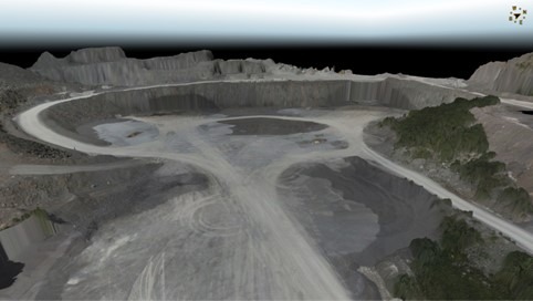
Our survey area with and without stocks, showing the baseline terrain.
For me, this is the key to good stockpile inventory. Be consistent with the survey assumptions and minimise every error possible. This is when the accuracies really zone in, and the survey proves its worth.
Leaping Wing conducts regular stockpile surveys across England and Wales. Get in touch with us for a no-obligation call to discuss your inventory requirements.