Surveying for the Pretty Picture
Want to save a bunch of time creating top-quality ortho imagery? Read on to find out the secrets, and also a great trick for improving quality.
We had an unusual job recently: a large-scale mapping task with the aim of producing an orthometric image of the best possible aesthetic quality. ‘Orthometric’, if you are not familiar, refers to the composite overhead view of the area with the perspective removed.
The job poses some interesting questions for both capture and processing:
- Shoot on a cloudy day (which we would normally recommend) or full sun?
- Shoot RTK or non-RTK?
- Mechanical or electronic shutter?
- RAW or JPG imagery?
- How to minimise distracting artefacts, especially hole-ridden tree foliage which is common in routine surveys
The tempting answer is ‘shoot everything top quality and sort it out later’ but that brings some significant drawbacks, Endless mechanical shutter capture reduces camera/lens life. RAW imagery is a dog to process and adds a lot of time to the post-processing. Likewise, RTK base stations take time to establish, and move between take-off locations.
The better answers: do some testing. So we did, and here are some of the results.
RTK – with or without?
There is a theory that RTK will improve the quality of stitch at the exact positions of the images are largely determined by accurate GPS metadata.
Answer: without is fine
In our test we could determine no difference between the RTK and non-RTK capture. Note, however, that we have seen improvements in detailed 3D mode outputs using RTK, but for ortho imagery we couldn’t see any benefit
(Non-RTK capture – we could find no defects compared to the RTK)
Mechanical or electronic shutter?
We would normally always use a mechanical shutter for measured survey work, to mitigate the effects of rolling shutter.
Answer: Electronic
Again, the easier (or more kit friendly option) proved to be absolutely. The rolling shutter correction in our software was easily sufficient to mitigate any possible visual artefacts.
Cloudy or Sunny?
(and how vital is consistency?)
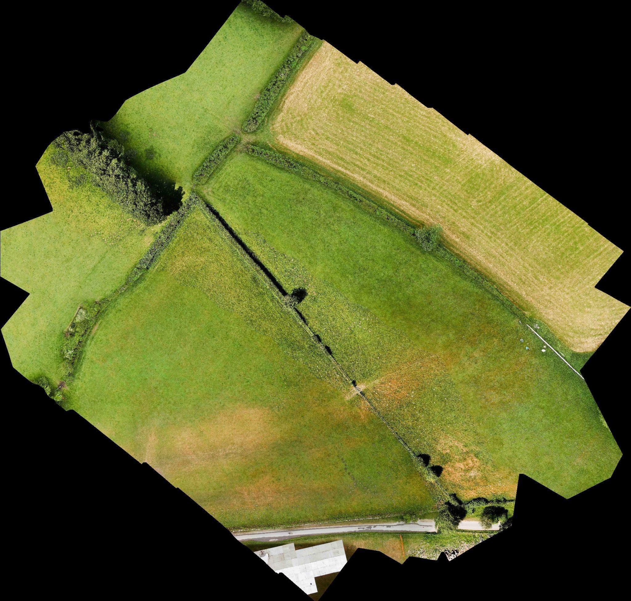
For measured survey, cloudy conditions would always be preferred. The lesser dynamic range means that important details do not get lost in shadows or highlights.
Answer: Sunny
This is where aesthetics trump measurable data. Capture in sun gave punchier colours and shadows of hedgerows and trees gave a pleasing relief to the end product.
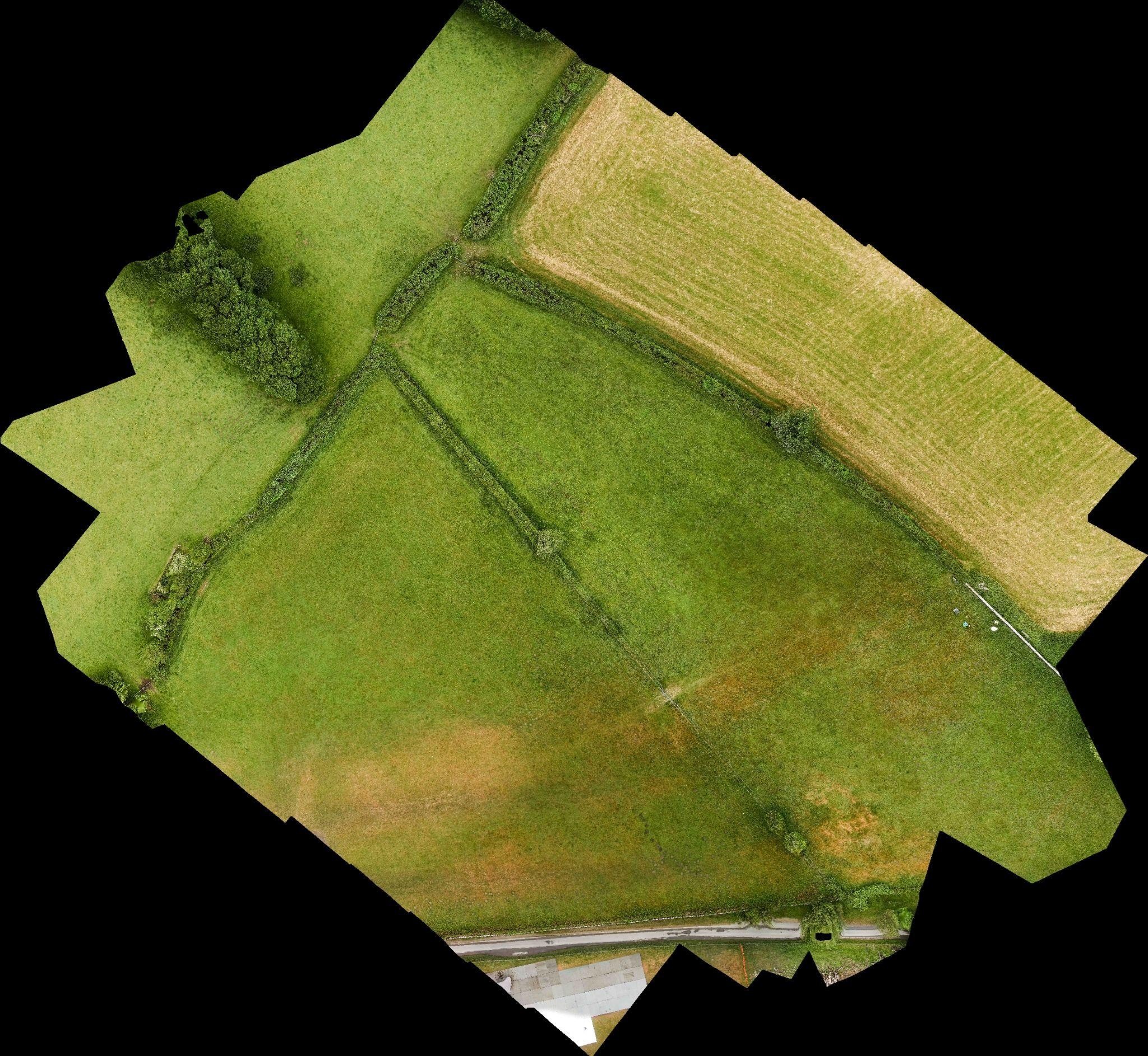
We also concluded from testing that brief cloud interludes were not a disaster. Our software did a good job of blending adjacent sunny and cloudy regions. However, excessive cloud shadows on the landscape were a little troublesome, although they could be improved in the final product using Lightroom or Photoshop.

(Cloudy conditions)
(Combination of cloudy and sunny images in adjacent flight lines)
RAW or JPG?
Whilst RAW imagery slows up the capture and introduces issues for storage and processing time, our expectation was that shooting sensor output would give us a better-quality result.
Answer: JPG
A caveat here: as long as your sensor has a decent dynamic range in its capture profile then JPG will most likely be indistinguishable from RAW, provided the end product is tuned in the likes of Photoshop. But for low-end cameras, you may well find that RAW brings detectable benefits.
A Good Trick – Lower Resolution DEMs
One issue we were very keen to avoid was holes in trees and bushes. These are normally almost impossible to avoid and caused by movement of trees and branches which create havoc in the image alignment process.
The answer here is a counterintuitive one: make the elevation map which is the source of the finished produce WORSE. We had consistently better results working from a lower resolution DEM. In a measurable output this would have intolerable effects on accuracy, but for a visual project the results are much improved.
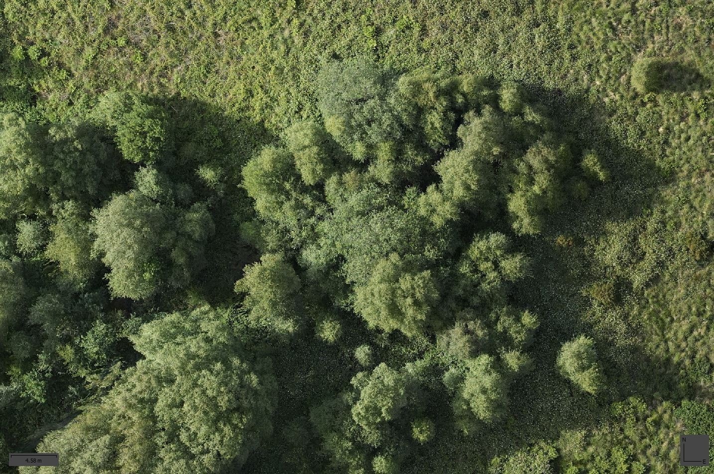
(Same area in result, with not holes or artefacts in trees)
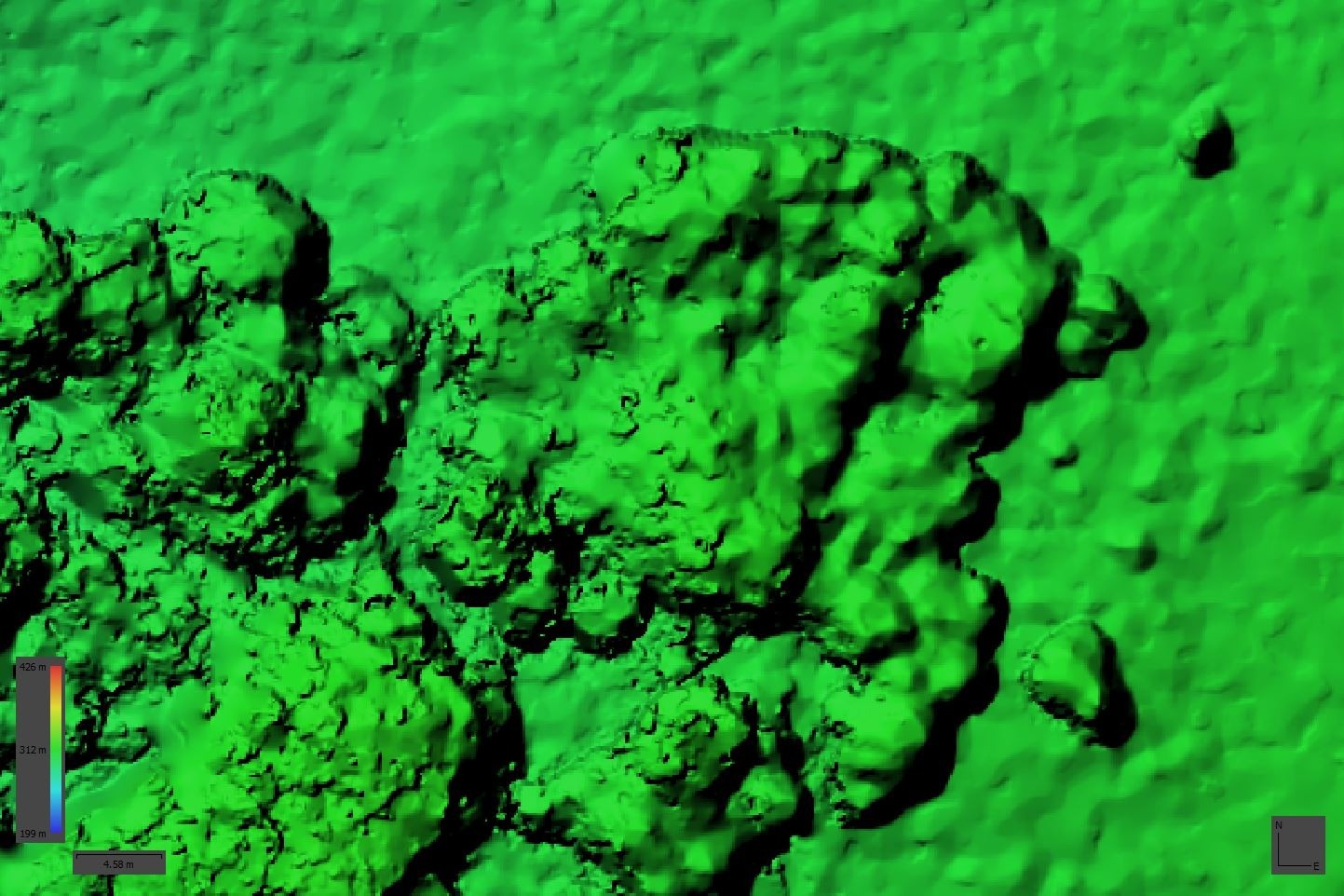
(Intentionally low-res DEM source for ortho)
In summary
The most painful solutions are not always the best. And remember our three golden rules:
TEST, TEST and TEST!